How do I find code violation leads in Akron, Ohio?
Akron publishes its High Grass & Weeds nuisance cases — a code violation list flagging neglected properties — free on the city GIS portal at agis.akronohio.gov. Open the layer's Query page to pull each case number, property address, and parcel ID.
How do I pull code violations records step by step?
The City of Akron publishes its High Grass & Weeds Cases on the city GIS portal — properties in active nuisance enforcement, a strong sign of a vacant or neglected property whose owner may be motivated to sell.
Go to the City of Akron GIS page
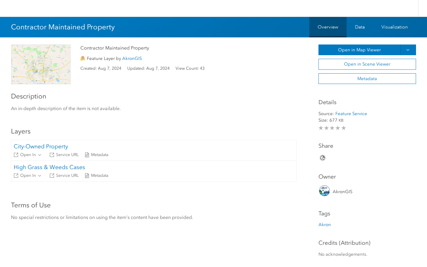
Navigate to the City of Akron's GIS item page for Contractor Maintained Property. This is where Akron publishes properties in active nuisance enforcement, including its High Grass & Weeds Cases layer.
Open the High Grass & Weeds Cases layer
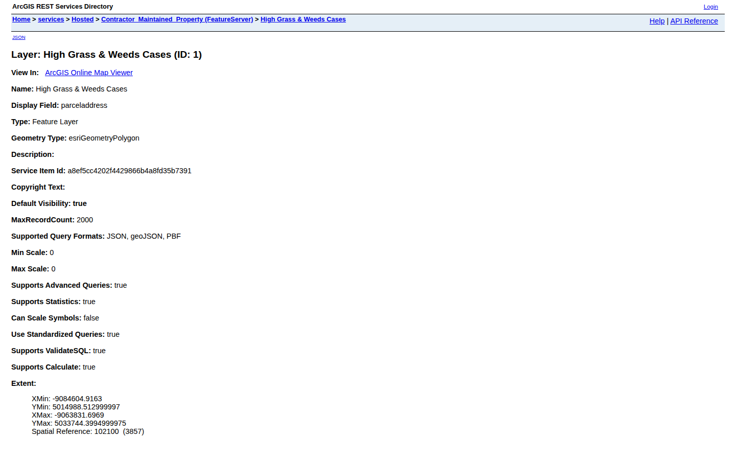
Under the Layers section, find High Grass & Weeds Cases and click its Service URL link. A plain data page opens describing the layer. You can also click the Data tab at the top of the item page to browse the records in a table.
Open the Query page
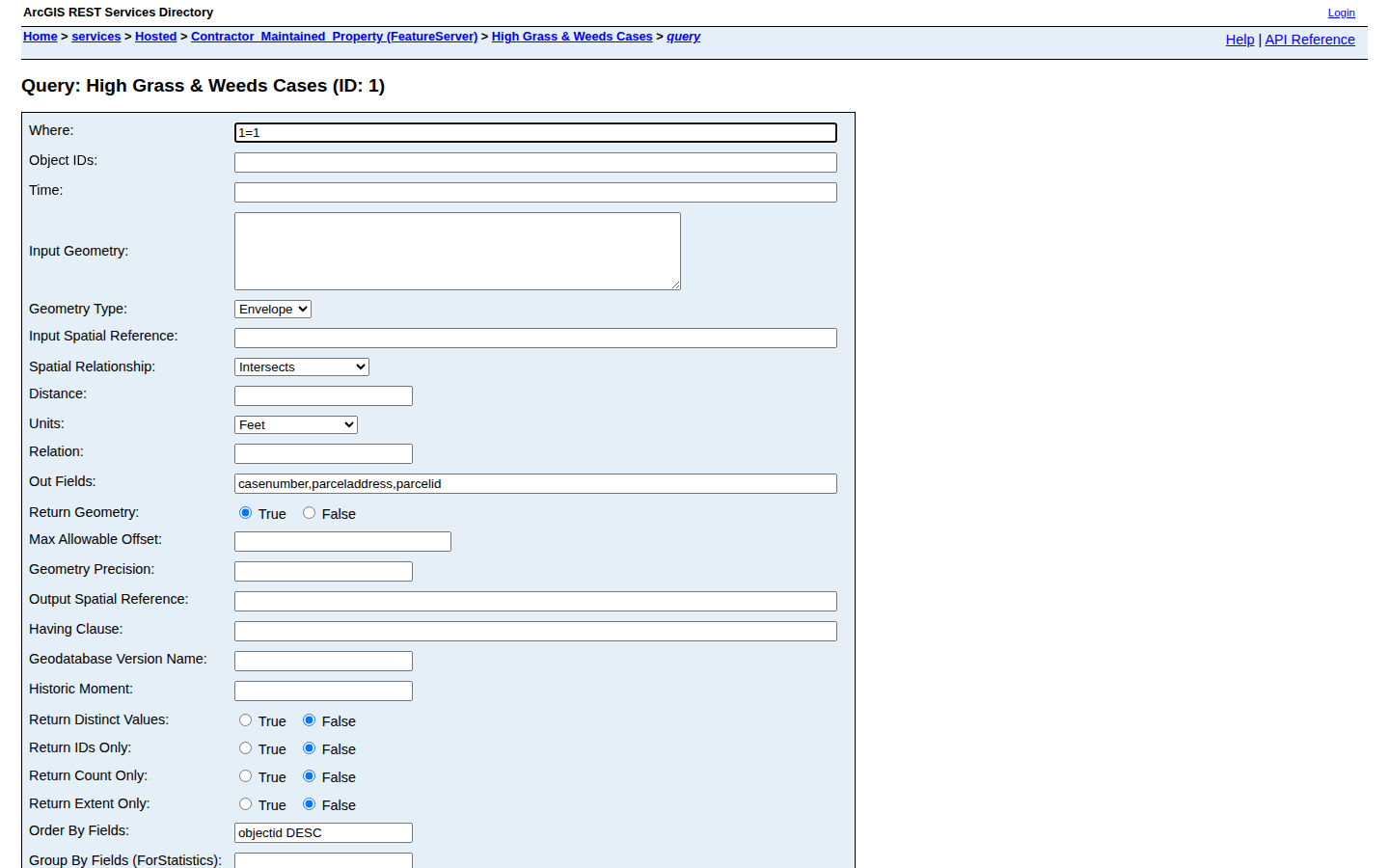
Scroll to the bottom of the layer page and click the Query link. In the form, type 1=1 in the Where box (this means show everything) and enter casenumber,parceladdress,parcelid in the Out Fields box.
Sort newest cases first
In the Order By Fields box type objectid DESC so the most recently added cases appear at the top, set Format to HTML, then click Query (GET). The matching case records appear below the form.
Record the data
For each case, note the case number, the property address, and the parcel ID. Every record on this list is a High Grass & Weeds nuisance case — a strong sign of a vacant or neglected property whose owner may be motivated to sell.
What property data does Summit County publish?
| Code Violations | agis.akronohio.gov · ArcGIS · FREE |
Common questions
Live in CountyPull for Summit County right now
| List type | Records | New in 30 days |
|---|---|---|
| Code Violation | 2,838 | 0 |
| Foreclosure | 41 | 0 |
CountyPull pulls Summit County fresh every morning — cleaned, deduped, skip-trace ready. The free plan includes 100 rows every month.
Get 100 Free Leads →